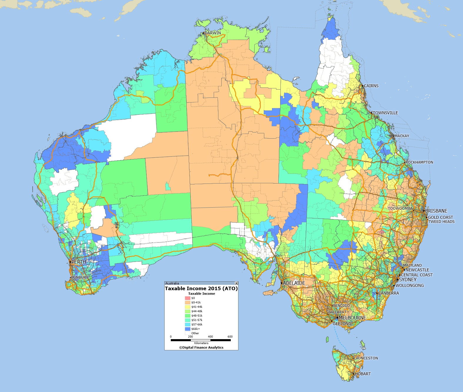
Using data from the latest ATO release from 2015, we can map average taxable incomes to post codes. Of course taxable incomes are the residual amounts the tax authorities get their hands on after tax management strategies (such as allowances, expenses, trusts, negative gearing, income sharing and the like) so they do not tell the full story. Nevertheless the results are interesting.
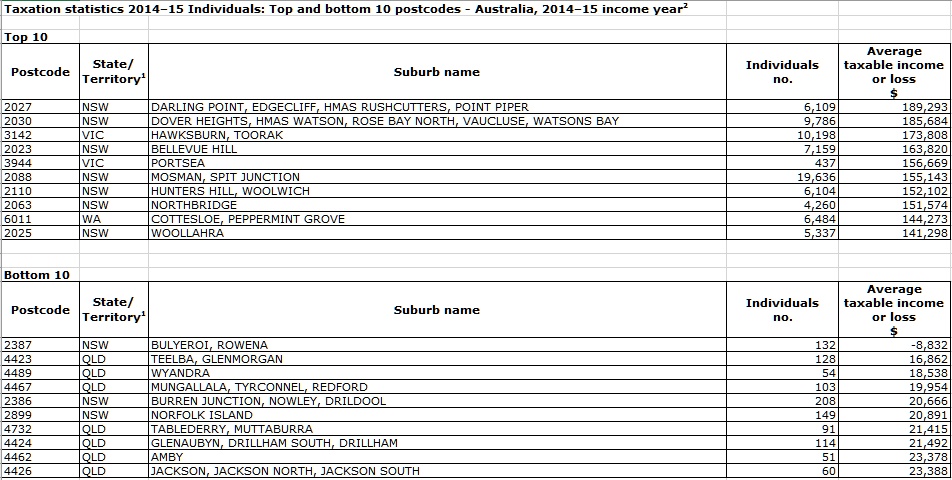
 The blue areas show the zones of highest taxable income. Here are the top and bottom postcodes from the list, Australian wide.
In coming days we will drill into the various states, again with interesting results.


6 thoughts on “Taxable Income Mapping Australia 2015”